Geographical location
our complete brochure
Zenica-Doboj Canton (ZDC) is located in the central part of the state of Bosnia and Herzegovina (B&H), which, according to the provisions of the Dayton Agreement, consists of the Federation of B&H (FB&H), Republic Srpska (RS) and Brcko District (DB B&H).
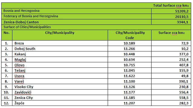
It covers an area of 3344.1 km2 and the largest, Zenica-Doboj Canton, ranks fourth in the Federation of Bosnia and Herzegovina. It is located between 17°44’38” and 18°50’11” meridians, and 43°54’13” and 44°43’41” parallels (in geographical coordinates, according to the geodetic reference system of the State Institute for Geodetic Administration), i.e. Between 6,479,595 m and 6,566,872 m along the x-axis, and between 4,862,166 m and 4,953,741 m along the y-axis (in projected coordinates).
In the northeast and north, this Canton borders with the Republic Srpska, in the northeast and east with the Tuzla Canton, in the south with the Sarajevo Canton, in the southwest and west with the Central Bosnia Canton, and in the east with the Republic Srpska.
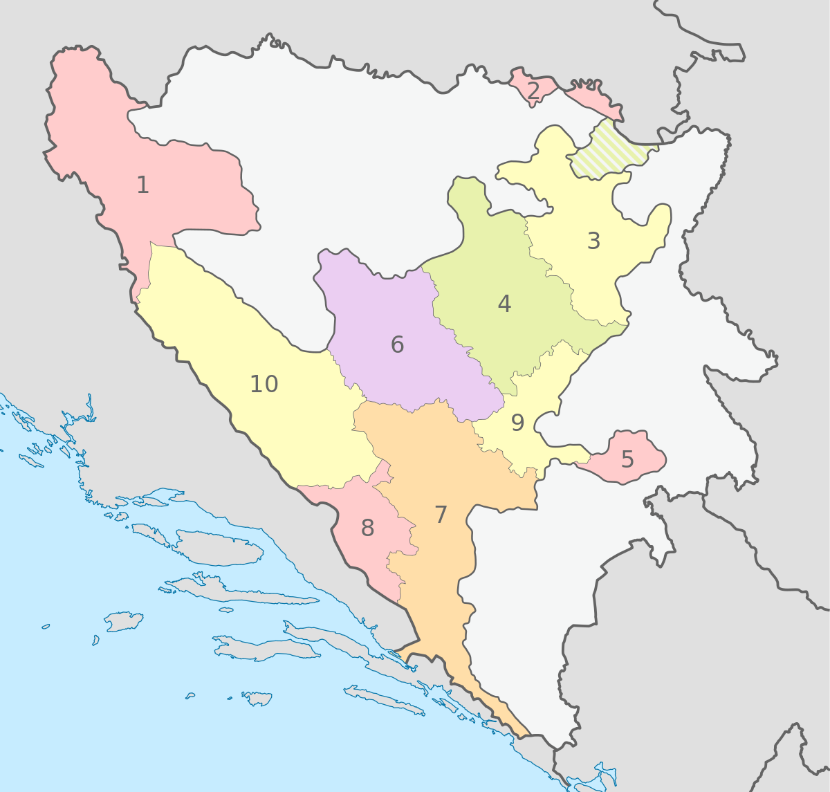
As one of the 10 federal administrative units within the Federation of Bosnia and Herzegovina, Zenica-Doboj Canton has ten municipalities: Breza, Doboj South, Kakanj, Maglaj, Olovo, Tešanj, Usora, Vareš, Zavidovići, Zepče and two cities: the city Visoko and the city of Zenica.
The city of Zenica is also the administrative seat of ZDC.